Trails / Pigeon River Country
Open
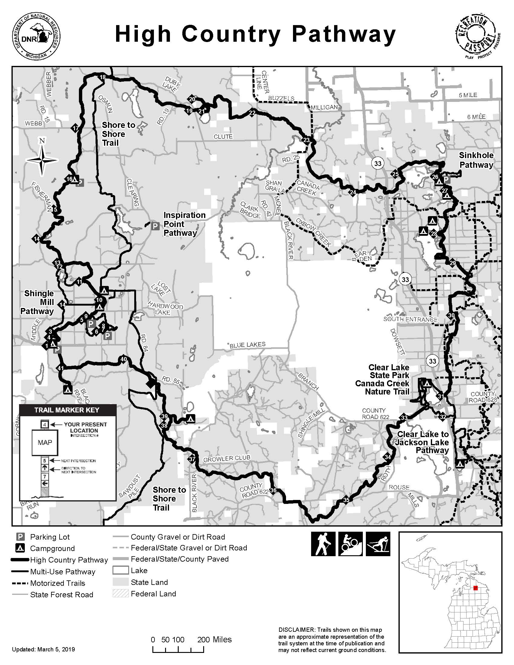
An 80-mile loop through the Pigeon River Country — one of the longest hiking and mountain-biking trails in Michigan, home to one of the largest free-roaming elk herds east of the Mississippi.
Map & Directions
Nine state forest campgrounds sit along the pathway, and the trail can be accessed at the Pigeon River Country State Forest Headquarters on Twin Lakes Road in Vanderbilt.
About the Trail
The High Country Pathway is one of the most unique and longest hiking and mountain-biking trails in the state. The 80-mile loop trail system passes through habitats ranging from rolling hardwood forests to cedar swamps, and is home to one of the largest free-roaming elk herds east of the Mississippi. Beyond hiking and mountain biking, cross-country skiing and snowshoeing are available in the winter.
There are nine state forest campgrounds along the pathway for trail users to spend the night or to access the trail from. The trail can also be accessed at the Pigeon River Country State Forest Headquarters, found on Twin Lakes Road in Vanderbilt.
Although the trail is on state land managed by the Michigan Department of Natural Resources, it has an active volunteer group who manages trail maintenance. See what they are up to on Facebook.
Get Involved
Trails are built and maintained by volunteers and donors. Join us.